Mullengandra Landcare Group: Land Management Plan - Sensitive Land
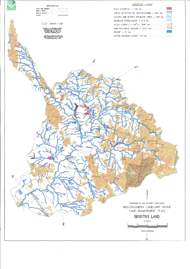
Map showing infrastructure, crown land and sensitive lands (salt outbreak, areas affected by waterlogging, gullies and incised drainage lines, drainage depressions, steep lands, high recharge hazard, swamp, active erosion).
Publisher: Department of Land and Water Conservation
Cost: Free
Language: English
File: PDF 1.8 MB / Pages 0
Name: mullengandra-landcare-group-land-management-plan-sensitive-land.pdf