Glenrock Lagoon is located on the Hunter coast of New South Wales, just south of Newcastle. It is classed as a small creek.
Although impacted by an urban-fringed catchment, Glenrock Lagoon is nestled in a protected valley away from the busy suburbs above and is a mecca for various recreational pursuits.
Water quality report card
As part of our water quality monitoring program we assess the water quality and ecosystem health of an estuary using a range of relevant indicators. We sample a subset of the estuaries located between Taree and Wollongong every 3 years. The most recent sampling in Glenrock Lagoon was completed over the 2019–20 summer when 2 sites were sampled on a monthly basis.
This report card represents 2 water quality indicators that we routinely measure: the amount of algae present and water clarity. Low levels of these 2 indicators equate with good water quality.
Algae
Water clarity
Overall grade
The report card shows the condition of the estuary was good with:
- algae abundance graded good (B)
- water clarity graded fair (C)
- overall estuary health graded good (B).
Grades for algae, water clarity and overall are represented as:
- A – excellent
- B – good
- C – fair
- D – poor
- E – very poor.
Go to estuary report cards to find out what each grade means, read our sampling, data analysis and reporting protocols, and find out how we calculate these grades.
We have monitored water quality in Glenrock Lagoon since 2010. This table shows the water quality grades for this estuary over that time.
| Year | Algae | Water clarity | Overall grade |
|---|---|---|---|
| 2010–11 | C | D | D |
| 2013–14 | B | D | C |
| 2016–17 | B | C | B |
Physical characteristics
| Estuary type | Creek |
|---|---|
| Latitude | –32.96 (ºS) |
| Longitude | 151.74 (ºE) |
| Catchment area | 7.4 km2 |
| Estuary area | 0.1 km2 |
| Estuary volume | 15.1 ML |
| Average depth | 0.3 m |
Notes: km2 = square kilometres; m = metres; ML = megalitres.
Water depth and survey data
Bathymetric and coastal topography data for this estuary are available in our data portal.
Land use
Glenrock Lagoon drains a highly disturbed catchment. The lagoon and bushland of Glenrock State Conservation Area are surrounded by urban development. The conservation area offers a large network of heavily used walking and mountain bike trails, and a scout camp lies adjacent to the estuary.
National and marine parks
- Glenrock State Conservation Area encompasses most of this catchment.
- This estuary does not flow into a marine park.
Community involvement
- The Hunter Region Landcare Network provide resources and links to local landcare groups active within the Hunter River region.
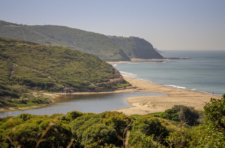
Aerial view of Glenrock Lagoon
Local government management
Local councils manage estuaries within their area unless the estuary is attached to a marine park. Glenrock Lagoon is managed by Newcastle City Council and marks the southern coastal boundary of the council’s local government area.
Threatened species
Glenrock Lagoon catchment contains a rare stand of littoral rainforest, an endangered ecological community in the NSW North Coast, Sydney Basin and South East Corner Bioregions.
Read more about the biodiversity in our estuaries.