The NSW Government has invested $2.3 million through the Digital Restart Fund to establish the NSW Wildlife Drone Hub – a commitment to give New South Wales a drone capability for biodiversity monitoring.
What we do
The NSW Wildlife Drone Hub enables land managers in New South Wales to survey biodiversity using drones. Our goal is to make biodiversity surveys more efficient and encourage the consistent uptake of drones for the management of biodiversity.
The Drone Hub provides specialised training that enables the use of drones to detect both wildlife and vegetation.
The Drone Hub manages the data collected by drones and provides digital tools and advanced artificial intelligence (AI) analytics. This data will be accessible through a digital dashboard that allows managers to analyse and interact with the data in real time.
Through research and operations, the Drone Hub has completed the following:
- 4,957 drone flights
- 21,452 km flown
- 1,276 koalas found
- 12,054 animals found.
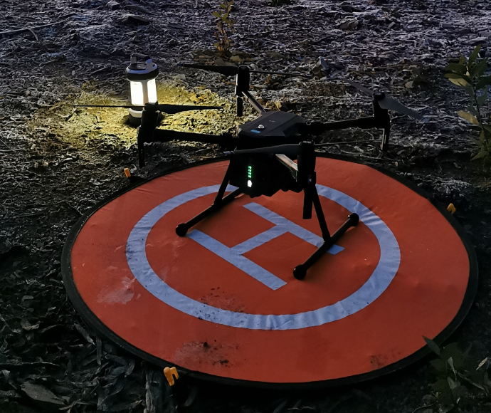
Drones can survey complex, dangerous or sensitive terrain.
Why we use drones
Drones fitted with thermal cameras can survey complex, dangerous or sensitive terrain to detect wildlife. Some advantages of drones over traditional on-ground operations include less disturbance, improved detection and survey efficiencies.
A single drone can survey between 100 to 200 hectares a night, as they travel at 30 km an hour. Drones, however, are often deployed at the same time as ground surveys as complementary approaches.
Drone surveys
The NSW Wildlife Drone Hub has validated methods for surveying fauna using drones.
Equipped with thermal cameras, drones are flown at night when ambient temperatures are coolest. Drones fly in a pattern in the same way someone might mow a lawn. They survey in parallel lines to search the forest canopy.
If a detection is made, the drone pilot stops to identify the species. Smaller infrared detections are usually small creatures like greater gliders and bats. Our drones have powerful spotlights they can turn on so that the animal can be photographed and identified using a zoom lens.
Drone Data Portal
The NSW Wildlife Drone Hub will offer a portal where drone footage is stored and processed. Users will be able to upload animal detection footage and access a suite of digital tools, including a pre-trained artificial intelligence (AI) object detection model.
Using available data, the Drone Hub dashboard will provide live updates of animals detected, number of flights, the area covered and the number of drone pilots undertaking surveys.
Artificial intelligence and autonomous flight programs
Drone surveys create a large amount of data about animals in their environment. The Drone Hub’s autonomous, terrain-aware flights can be repeated over time with high precision to detect trends.
The NSW Wildlife Drone Hub is training an AI model to detect and identify animals in near real time. This technology will be accessible through the NSW Wildlife Drone Hub and can be applied consistently across New South Wales.
Koala conservation and collaboration
How the NSW Wildlife Drone Hub is helping to conserve koalas
The NSW Wildlife Drone Hub is working with the NSW Koala Strategy to refine survey methods using drones across different forest types, terrain and koala population densities. We are also training pilots for the NSW Koala Strategy to support landscape-scale operations.
The Drone Hub has also undertaken a range of project and research commissions to detect koalas and other threatened species for the Natural Resources Commission, the Department of Climate Change, Energy, the Environment and Water, and the National Parks and Wildlife Service.
All drone and koala sighting data will be stored in the Drone Data Portal for analysis.
Research and development
Through strategic partnerships and key collaborations, the Drone Hub is bringing together scientific expertise in wildlife drone surveys in New South Wales. The Drone Hub is collaborating with the University of Newcastle and other organisations to undertake research in the following areas:
- efficient deployment of drones at a landscape scale
- environmental, landscape and seasonal limits of thermal drone technology
- landscape-scale koala density and occupancy models
- koala detection probability for thermal drones
- real-time artificial intelligence (AI) for automated thermal detection of koalas and coexisting species.
More information
- Drone thermal imaging technology provides a cost-effective tool for landscape-scale monitoring of a cryptic forest-dwelling speciesopens a new window
- Drone-derived thermal imagery outperforms traditional survey methods for an arboreal forest mammalopens a new window
- Autonomous drones outperform humans in locating koalas