Terry Hie Hie Aboriginal Area Plan of Management
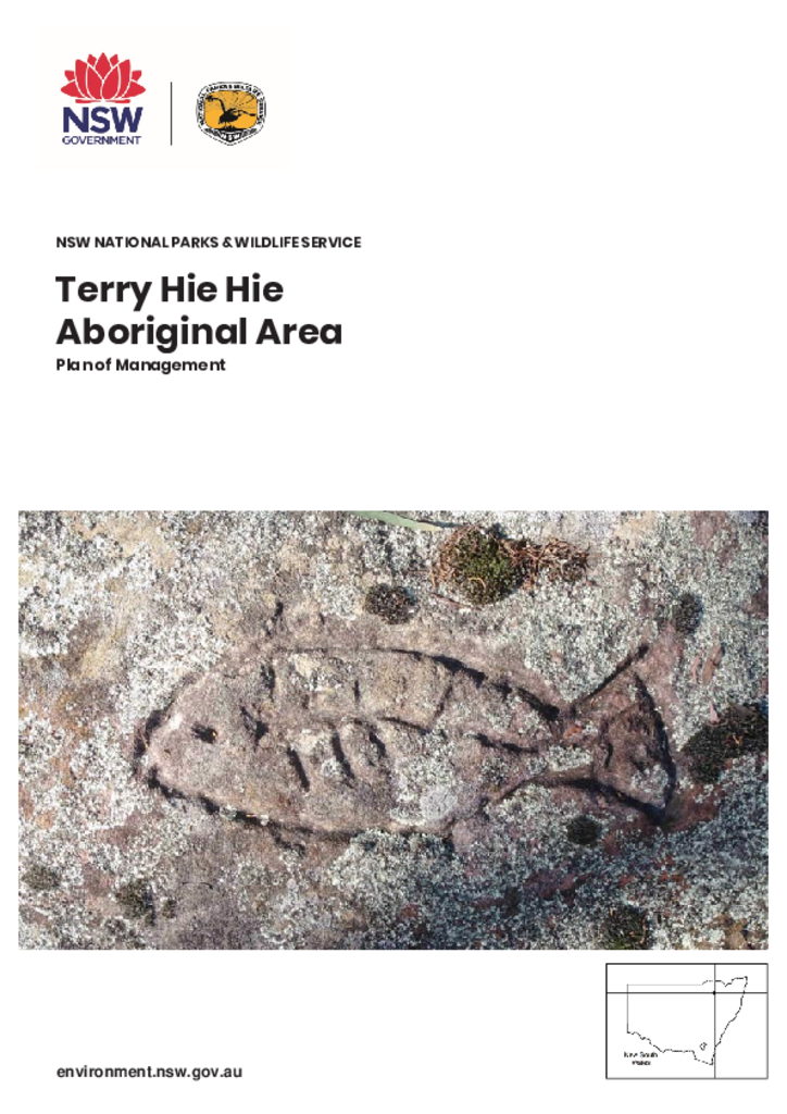
Terry Hie Hie Aboriginal Area is a special place for the Gamilaroi People, protecting ceremonial sites, art sites, tool making areas, burial sites, hunting grounds and places where Aboriginal people lived before and after contact with Europeans.
The National Parks and Wildlife Service (NPWS) is committed to cooperative management of the Aboriginal Area with the Gamilaroi People. The Terry Hie Hie Aboriginal Area Joint Management Committee was established in 2009 and, together with NPWS, developed a memorandum of understanding detailing cooperative management arrangements for the Aboriginal Area.
As well as protecting significant Aboriginal cultural values, Terry Hie Hie Aboriginal Area also supports habitat for four threatened ecological communities and 18 threatened native animals.
This plan of management, the first for this Aboriginal Area, provides for the continued protection of significant Aboriginal site values, Aboriginal cultural values and natural values.
First published in July 2020; reprinted August 2021 with corrections to layout.