Dharug National Park Plan of Management
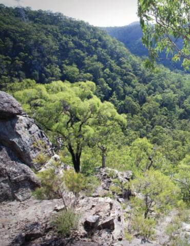
Dharug National Park covers about 14,834 hectares and is located on the north bank of the Hawkesbury River opposite the small settlement of Wisemans Ferry, some 55 kilometres from of the centre of Sydney and 25 kilometres west of Gosford. Established in 1967, the park features spectacular sandstone cliff-lines and gullies, a substantial section of the historic Old Great North Road and many Aboriginal sites.
Publisher: NSW National Parks and Wildlife Service
Cost: Free
Language: English
ISBN: 0-73107-6850
/
ID: NPWS19970126
File: PDF 84.69 KB / Pages 34
Name: dharug-national-park-plan-of-management-970126.pdf
The national park is an important element in the system of conservation areas comprising Marramarra, Popran, Brisbane Water and Ku-ring-gai Chase National Parks along with several nature reserves which protects the very high scenic values of the Hawkesbury River and Broken Bay.
Dharug National Park is also one of a large group of predominantly sandstone parks and reserves that forms a green belt around metropolitan Sydney. The maintenance of 'corridors of green' linking areas of bush land across a wide range of environments is important for the conservation of biodiversity within the Sydney sandstone biogeographical region.
Photo: Dharug National Park. Credit: Nick Cubbin/OEH.