The Shoalhaven River is a barrier river estuary with an open entrance. The estuary is large and flows from a freshwater river into the sea (the Shoalhaven Bight) between Bomaderry and Nowra. Thirty-four tributary streams flow into the river as it flows through the catchment, such as the Mongarlowe and Kangaroo Rivers.
Water quality
As part of our water quality monitoring program we assess the water quality and ecosystem health of an estuary using a range of relevant indicators. We sample a subset of the estuaries between Wollongong and the Victorian border every 3 years. The most recent sampling in the Shoalhaven River was completed over the 2021–22 summer, when 2 sites were sampled on a monthly basis.
This report card represents 2 water quality indicators that we routinely measure: the amount of algae present and water clarity. Low levels of these 2 indicators equate with good water quality.
Algae
Water clarity
Overall grade
This report card shows the condition of the estuary was good with:
- algae abundance graded good (B)
- water clarity graded good (B)
- overall estuary health graded good (B).
Grades for algae, water clarity and overall are represented as:
- A – excellent
- B – good
- C – fair
- D – poor
- E – very poor.
Go to estuary report cards to find out what each grade means, read our sampling, data analysis and reporting protocols, and find out how we calculate these grades.
We have monitored water quality in Shoalhaven River since 2007. This table shows the water quality grades for this estuary over that time.
| Year | Algae | Water clarity | Overall grade |
|---|---|---|---|
| 2007–08 | A | B | B |
| 2008–09 | B | A | A |
| 2009–10 | B | B | B |
| 2010–11 | B | B | B |
| 2011–12 | C | B | B |
| 2012–13 | B | B | B |
| 2013–14 | B | A | A |
| 2014–15 | B | B | B |
| 2015–16 | B | A | B |
| 2016–17 | B | A | B |
| 2017–18 | B | A | B |
| 2018–19 | E | B | C |
| 2019–20 | B | B | B |
| 2020–21 | B | B | B |
Physical characteristics
| Estuary type | Barrier river |
|---|---|
| Latitude (ºS) | –34.90 |
| Longitude (ºE) | 150.77 |
| Catchment area (km2) | 7085.8 |
| Estuary area (km2) | 31.9 |
| Estuary volume (ML) | 86508.6 |
| Average depth (m) | 2.9 |
Tidal exchange volume
Tidal exchange volume or tidal prism data is available for this estuary. This tidal prism was measured in 2005.
| Tide state | Flow (ML) | Local tidal range (m) | Sydney Harbour tidal range (m) |
|---|---|---|---|
| Ebb flow | 18,350 | 1.24 | 1.38 |
| Flood flow | 19,030 | 1.28 | 1.39 |
Notes: km2 = square kilometres; m = metres; m3 = cubic metres; ML = megalitres.
Water depth and survey data
Bathymetric and coastal topography data for this estuary are available in our data portal.
Land use
The catchment for Shoalhaven River estuary is one of the larger catchments on the south coast at more than 700,000 hectares in size. The catchment is moderately disturbed and include about 60% forest. It extends inland from the township of Nowra and south towards the township of Moruya and includes Morton National Park and Mount Budawang.
Grazing areas, including those around Braidwood, form about 30% of the catchment area. Urban areas occupy less than 5% of the catchment, including Nowra.
National and marine parks
- The largest conservation area in the Shoalhaven River catchment is Morton National Park.
- There is no marine park associated with the Shoalhaven River.
- Comerong Island Nature Reserve sits at the mouth of the Shoalhaven River and is an internationally recognised habitat for a range of shorebirds and waders.
Citizen science projects
- Conjola Jerrawangala Landcare is a citizen science project to report seasonal occurrence of flowers, seeds and animals in the region.
Community involvement
- Shoalhaven Landcare Association is a volunteer community-based conservation group.
- The 2018 National Indigenous Fire Workshop was held at Bundanon in the Shoalhaven Catchment.
- Local conservation group Friends of Bomaderry Creek work to regenerate native plants and animals in local bushland.
- The NSW Environment Protection Authority (EPA) has released advice for eating fish from the Shoalhaven River. For more information, check the EPA website.
Other features
- The Nowra Bridge, which joins Nowra and Bomaderry, is of state heritage significance. It was built in 1881 and designed by famous American engineer C Shaler Smith.
Seafood harvest area status
The NSW Food Authority website lists the current status of oyster/shellfish harvest areas.
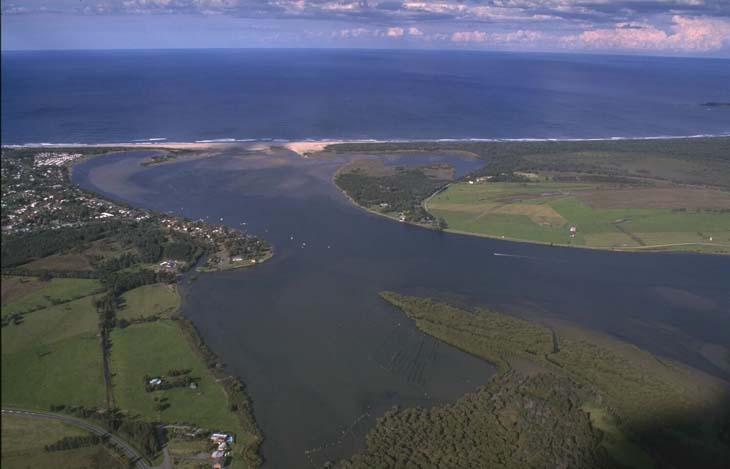
Aerial view of Shoalhaven River estuary.
Local government management
Local councils manage estuaries within their area unless the estuary is attached to a marine park. Shoalhaven City Council manages this estuary.
Threatened species
A number of threatened species can be found in the Shoalhaven catchment, such as the albatross mallee and Bomaderry zieria.
Find out about the biodiversity in our estuaries.