Currarong Creek is classed as an estuarine creek with an intermittently closed entrance located near Jervis Bay. The town of Currarong is built around the creek and is surrounded by native bushland.
Water quality report card
As part of our water quality monitoring program we assess the water quality and ecosystem health of an estuary using a range of relevant indicators. We sample a subset of the estuaries between Wollongong and the Victorian border every 3 years. The most recent sampling in Currarong Creek was completed over the 2020–21 summer, when 2 sites were sampled on a monthly basis.
This report card represents 2 water quality indicators that we routinely measure: the amount of algae present and water clarity. Low levels of these 2 indicators equate with good water quality.
Algae
Water clarity
Overall grade
The report card shows the condition of the estuary was excellent with:
- algae abundance graded excellent (A)
- water clarity graded good (B)
- overall estuary health graded excellent (A).
Grades for algae, water clarity and overall are represented as:
- A – excellent
- B – good
- C – fair
- D – poor
- E – very poor.
Go to estuary report cards to find out what each grade means, read our sampling, data analysis and reporting protocols, and find out how we calculate these grades.
We have monitored water quality in Currarong Creek since 2011. This table shows the water quality grades for this estuary over that time.
| Year | Algae | Water clarity | Overall grade |
|---|---|---|---|
| 2011–12 | A | A | A |
Physical characteristics
| Estuary type | Creek |
|---|---|
| Latitude | –35.01 (ºS) |
| Longitude | 150.82 (ºE) |
| Catchment area | 12.3 km2 |
| Estuary area | 0.03 km2 |
| Estuary volume | 8.6 ML |
| Average depth | 0.2 m |
Notes: km2 = square kilometres; m = metres; ML = megalitres.
Water depth and survey data
Bathymetric and coastal topography data for this estuary are available in our data portal.
Land use
The catchment of Currarong Creek is relatively undisturbed, with over 95% forest and less than 1% of land used for urban development at the coastal township of Currarong.
National and marine parks
- There are no conservation areas in the Currarong Creek catchment.
- The Currarong Creek is within the Jervis Bay Marine Park and the entrance of the estuary is included in the habitat protection zone for the marine park.
Community involvement
- A community consultation on the Currarong Creek Flood Study was held in early 2019 as part of work being done by the Shoalhaven City Council to develop a floodplain risk management plan.
- Currarong Village Bushcare is a local voluntary environmental group.
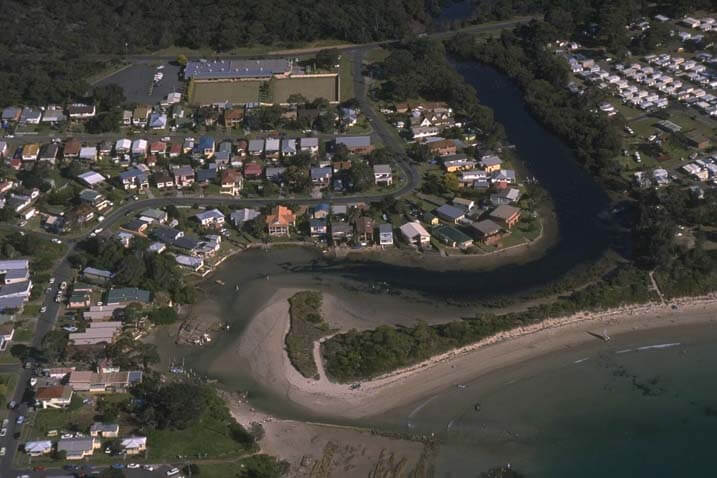
Aerial view of Currarong Creek
Local government management
Local councils manage estuaries within their area unless the estuary is attached to a marine park. Currarong Creek estuary is managed by Shoalhaven City Council and the NSW Department of Primary Industries and Regional Development as part of the Jervis Bay Marine Park.
Threatened species
Currarong Creek contains unique vegetation communities, including saltmarsh, mangroves and seagrass.
Read more about the biodiversity in our estuaries.