In 2018–19 dry and hot conditions continued in the Namoi catchment. The lowest inflows on record resulted in one of the worst droughts in documented history. There was a zero per cent available water determination for general security licences in the lower Namoi, with the Commonwealth Environmental Water Holder (CEWH) retaining a small volume of held water for the environment as carryover.
Keepit Dam fell below 1% of its storage capacity in December 2018, resulting in cease-to-flow conditions along the length of the Namoi River from Keepit Dam to Walgett.
The Department of Planning, Industry and Environment – Environment, Energy and Science (DPIE–EES) does not hold water entitlements in the Namoi catchment. We work with the CEWH to determine the most effective use of available water.
The Peel catchment also experienced record low inflows during 2018–19. Although 1900 megalitres of environmental contingency allowance and 477 megalitres of general security water was available for the environment, ecological water requirements were met by rain-fed tributary flows late in 2018. The DPIE–EES Water for the Environment Team subsequently advised against the use of the available environmental water.

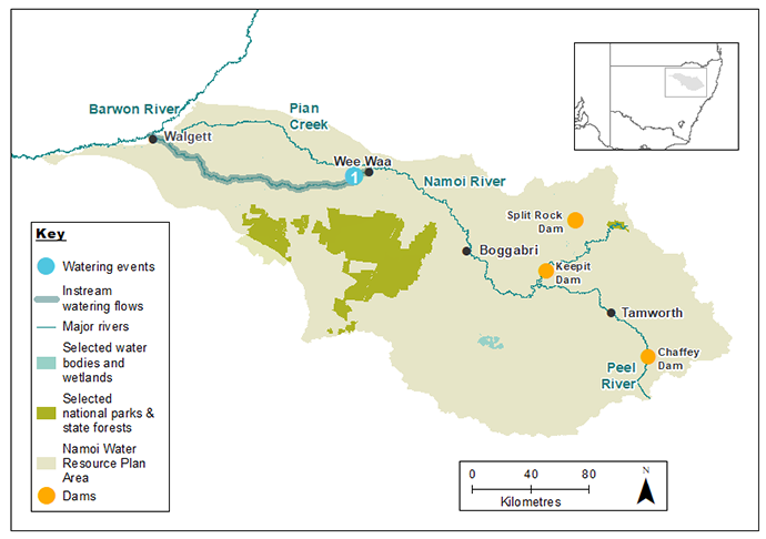
Map of the Namoi catchment showing waterways, wetlands and locations of water for the environment deliveries made in 2018–19.
Watering aims
Against the back drop of a deepening drought, the purpose of water for the environment is to support native fish by providing:
- access to refuge habitat
- opportunities for movement
- improved water quality in river pools.
The aim of water use in the Namoi was to support pool habitats of native fish downstream of Wee Waa.
Water delivery
This table provides a summary of water for the environment delivered in the Murray-Lower Darling catchment during the 2018–19 watering year. Volumes are indicative only.
Notes: Location numbers in the table relate to watering events marked on the map.
NSW = NSW licensed environmental water; CEW = Commonwealth licensed environmental water; EWA = Environmental water allowance accrued under the Water Sharing Plan for the Upper Namoi and Lower Namoi Regulated River Water Sources 2016; * indicates this event was managed by the Commonwealth Environmental Water Holder with support from the Department of Planning, Industry and Environment and delivered through CEW licences.
| Watering event number | Location | Start date | Finish date | NSW | CEW | EWA | Total |
|---|---|---|---|---|---|---|---|
| 1 | Lower Namoi downstream of Gunidgera | 9 Nov 2018 | 15 Dec 2018 | – | *5500 | – | *5500 |
| Region | Total |
|---|---|
| CEW | 5500 |
| Total | 5500 |
Outcomes
Between November and December 2018, 5.5 gigalitres of Commonwealth water for the environment was delivered to the Namoi River downstream of Gunidgera Weir to improve water quality and support refuge habitat for native fish. This water, plus the drawdown of Gunidgera Weir Pool, replenished water holes along 150–200 kilometres of the Namoi River between Wee Waa and Walgett. Flows in the Namoi reached Walgett for the first time in more than 9 months, bringing short-term relief to this stretch of river.
The release improved the quality of water in the waterholes:
- increased dissolved oxygen levels above the 4 milligrams per litre needed to avoid stress in native fish
- enabled native fish to move along the river to find food and refuge
- enhanced the likelihood of survival of native fish such as golden perch, Murray cod and bony bream, many of these species are recreationally and culturally significant.
Case study
Management of water for the environment is done in the context of all river flows, catchment conditions and forecast and actual rain. Water managers monitor river conditions to work out whether a release of water is needed.
Native fish are particularly vulnerable during drought as river levels drop and connectivity between deeper pools reduces or is lost.
In 2018–19, the DPIE–EES Water for the Environment Team and the Commonwealth Environmental Water Holder chose not to request the release of 1900 megalitres of environmental contingency allowance or 477 megalitres of held water for the environment.
This decision followed rainfall in the catchment that provided adequate support to native fish populations in refuge pools along the Peel River. The rain events, while short and sharp, refreshed water levels and food supplies in pools and allowed fish a brief opportunity to move between pools.
Unused environmental contingency allowance, like general security allocations, cannot be carried over in the Peel River. The unused water remains in Chaffey Dam and will contribute to meeting critical water needs while the region remains in drought.

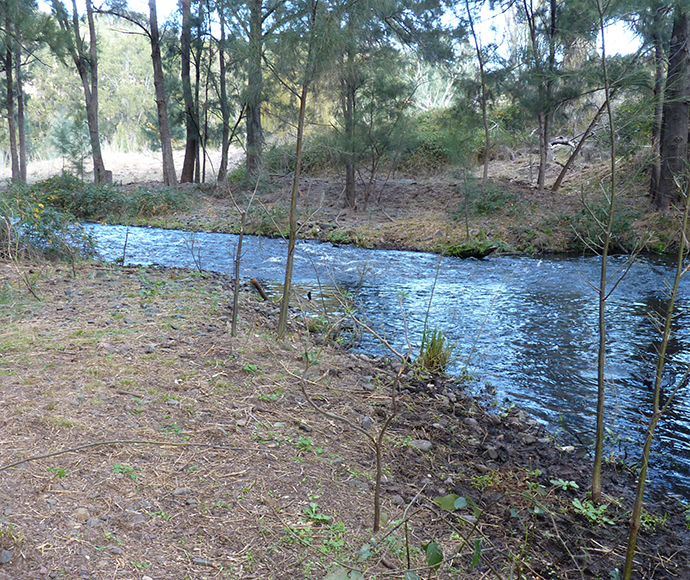
Peel River downstream of Chaffey Dam wall