Royal National Park is located on the southern fringe of Sydney. It is Australia’s oldest national park and one of the busiest in New South Wales.
There were over 6 million visits to Royal National park in 2018, putting it in the top two most visited parks in New South Wales.
The NSW National Parks and Wildlife Service (NPWS) has seen a significant and sustained increase in visitors coming to Royal National Park to enjoy the beaches, lagoons and waterfalls, especially on sunny weekends and holidays.
Accommodating all these visitors and protecting the environment is challenging. Good planning is essential to meet increasing demand and continue to improve visitor facilities to maximise opportunities and minimise impacts.
We think it is important to keep you informed and so invite you to be a part of the conversation about planning for the future.

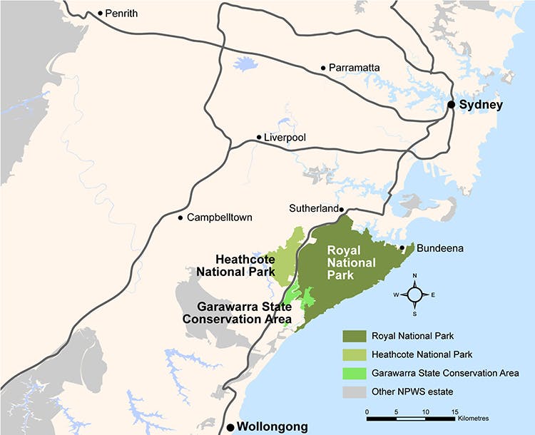
Map of Royal National Park
Planning for the future
Royal National Park, Heathcote National Park and Garawarra State Conservation Area Plan of Management
Plans of management guide what happens in our national parks, and how we manage them.
We have prepared a new plan of management for Royal National Park, Heathcote National Park and Garawarra State Conservation Area.
The future management of Royal National Park, one of the busiest parks in New South Wales, involves some particularly complex and important issues.
Royal National Park, Heathcote National Park and Garawarra State Conservation Area Mountain Biking Plan
We have prepared a mountain biking plan that will guide the establishment of environmentally sustainable mountain-biking experiences in these parks. It will progressively address the demand for cycling experiences in these parks through the authorisation and upgrade of appropriate tracks and the closure and rehabilitation of inappropriate tracks.
Updates


Register for updates – Wattamolla master plan
The information you provide in this form will only be used for the purpose for which it was collected. By submitting, you consent to storage, use, and disclosure of your personal information in accordance with our privacy policy. You can request access and amendment of your personal information.