Cakora Lagoon is situated at Brooms Head on the north coast of New South Wales. It is classed as a lagoon which has an intermittently closed entrance.
Water quality report card
As part of our water quality monitoring program we assess the water quality and ecosystem health of an estuary using a range of relevant indicators. We sample a subset of the estuaries located between the Queensland border and Taree every 3 years. The most recent sampling in Cakora Lagoon was completed over the 2021–22 summer, when 2 sites were sampled on a monthly basis.
This report card represents 2 water quality indicators that we routinely measure: the amount of algae present and water clarity. Low levels of these 2 indicators equate with good water quality.
Algae
Water clarity
Overall grade
The report card shows the condition of the estuary was good with:
- algae abundance graded excellent (A)
- water clarity graded fair (C)
- overall estuary health graded good (B).
Grades for algae, water clarity and overall are represented as:
- A – excellent
- B – good
- C – fair
- D – poor
- E – very poor.
Go to estuary report cards to find out what each grade means, read our sampling, data analysis and reporting protocols, and find out how we calculate these grades.
| Year | Algae | Water clarity | Overall grade |
|---|---|---|---|
| 2009–10 | C | E | D |
Physical characteristics
| Estuary type | Lagoon |
|---|---|
| Latitude | –29.6 (ºS) |
| Longitude | 153.33 (ºE) |
| Catchment area | 12.3 km2 |
| Estuary area | 0.4 km2 |
| Estuary volume | 113.5 ML |
| Average depth | 0.5 m |
Notes: km2 = square kilometres; m = metres; ML = megalitres.
Water depth and survey data
Bathymetric and coastal topography data for this estuary are available in our data portal.
Land use
The catchment of Cakora Lagoon relatively undisturbed as it is protected by Yuraygir National Park. Urban development around the small town of Brooms Head represents a small fraction of the land use. An unsealed road to Sandon passes within this small catchment.
National and marine park
- Cakora Lagoon is located within Yuraygir National Park.
- There are no marine parks associated with this estuary.
Community involvement
- Landcare groups in the Clarence Valley are supported by Clarence Landcare, North Coast Local Land Services and the Clarence Valley Council. These volunteer groups, including one at Brooms Head, work to conserve and manage coastal biodiversity.
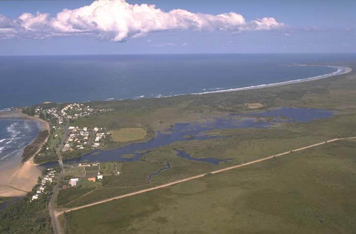
Aerial view of Cakora Lagoon
Local government management
Local councils manage estuaries within their area unless the estuary is attached to a marine park. Clarence Valley Council manages this estuary.
Threatened species
The coastal swamps of Cakora estuary provide critical habitat for the vulnerable olongburra frog.
Find out more about the biodiversity in our estuaries.