Waterbird breeding and river connectivity were the focus for environmental water management in the Intersecting Streams catchment in 2022–23.
Key outcomes
Under wet to very wet conditions, environmental water managers worked with partner agencies to coordinate the protection of water for the environment in the Intersecting Streams catchment to:
- help sustain waterbird breeding colonies at Narran Lakes
- improve system connectivity between the Condamine–Balonne rivers and the connected Culgoa–Birrie–Bokhara–Narran system
- improve the condition of wetland vegetation at Narran Lakes
- inundate some core areas of the western floodplain at Toorale National Park and State Conservation Area
- provide connection between the Warrego and Darling rivers
- inundate significant areas of wetlands along the Paroo River.

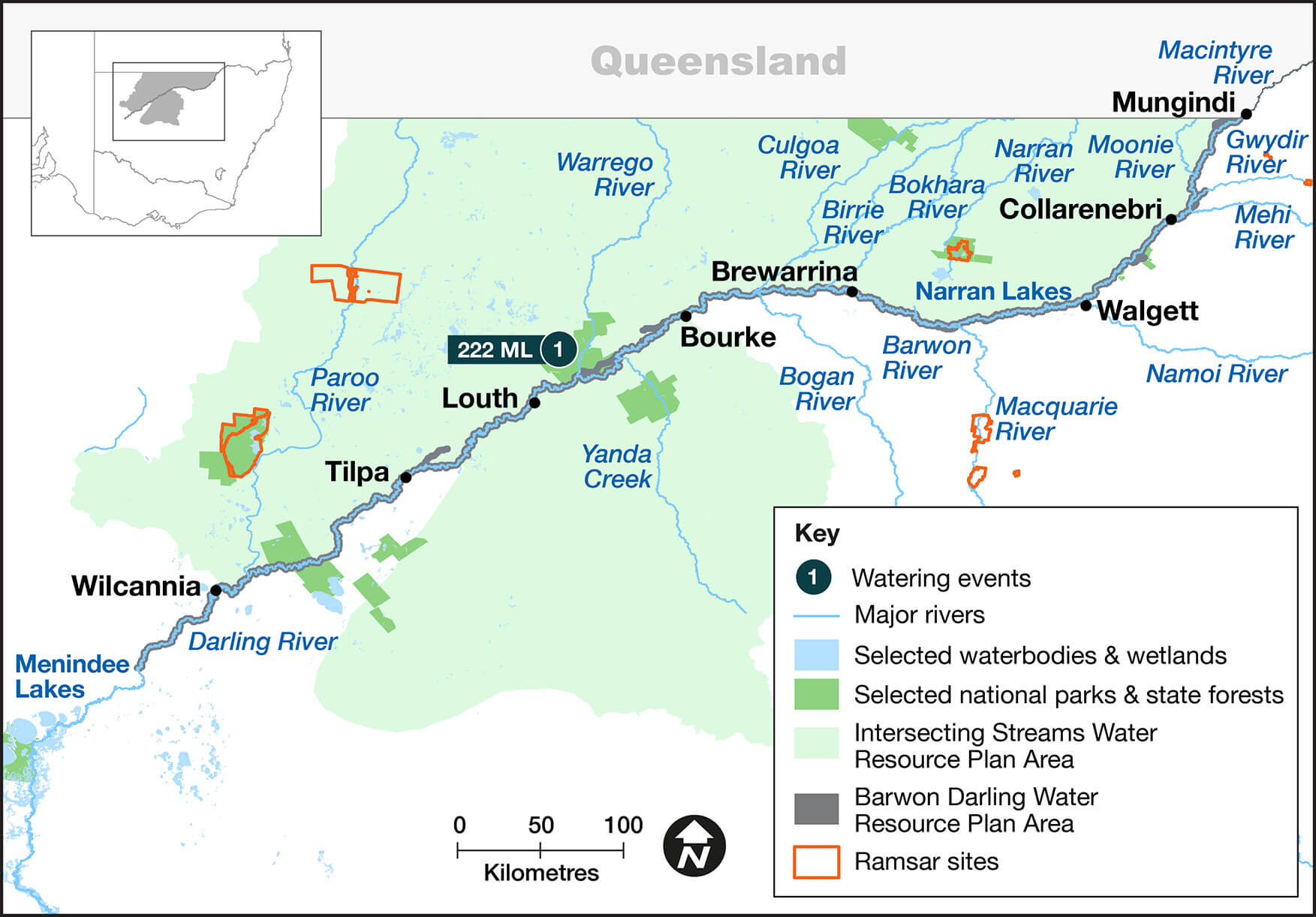
Map the Intersecting Streams catchment indicating the site where environmental water was delivered in the 2022–23 water year, with corresponding volume.
Catchment conditions
During the 2022–23 year, the Intersecting Streams catchment experienced La Niña weather conditions which resulted in high rainfall and moderate temperatures.
In late 2022, extended periods of high flow occurred across much of the catchment, and in parallel to the Condamine–Balonne catchment in Queensland. This triggered the Commonwealth’s Queensland environmental water entitlements.
Another smaller event in early 2023 saw a flow in the Warrego trigger Commonwealth licenses to direct flows to the western floodplain.
About the catchment
The Intersecting Streams catchment is in north-western New South Wales and covers an area of 120,431 square kilometres. Located in a semi-arid climate zone, rainfall is typically associated with northern summer monsoonal weather.
The area comprises 4 key river systems: the Paroo and Warrego rivers, the Culgoa–Birrie–Bokhara–Narran connected system, and the Moonie River that originates in Queensland and connects with the Barwon–Darling in wet years.
The Intersecting Streams catchment includes ephemeral streams and wetlands. Three wetlands in the Intersecting Streams catchment are Ramsar sites. Other wetlands in the catchment are wetlands of national significance and identified by Birdlife Australia as important bird areas.
Water for Country
The Intersecting Streams catchment is Country to the Barkindji, Budjiti, Euahlayi, Guwamu/Kooma, Gomeroi/Kamilaroi, Ngiyampaa, Kunja, Murrawarri and Ngemba Aboriginal peoples.
Water for Country is environmental water use planned by the Department of Planning and Environment and Aboriginal people to achieve shared benefits for the environment and cultural places, values and/or interests.
In the 2022–23 water year in the Intersecting Streams, environmental water managers:
- supported Barkindji Nation planning for the Toorale Cultural Watering Plan
- started to build relationships with the Toorale Joint Management Committee through meetings on Country.
Watering aims
The Annual environmental water priorities in the Intersecting Streams catchment 2022–23 were developed under a wet to very wet resource availability scenario. Objectives were to:
- support stocks of native fish and provide opportunities for them to breed and disperse into secure habitats
- increase the duration of inundation of water-dependent vegetation at Narran Lakes
- increase the duration of inundation of water-dependent vegetation on the western floodplain at Toorale
- ensure adequate vegetation condition and water level should further inflows trigger a colonial waterbird breeding event at Narran Lakes in spring 2022.
With wet to very wet conditions, water managers used plans devised at the start of the water year.
Water delivery
This table and chart provide a summary of 222 megalitres (ML) of water for the environment delivered in the Intersecting Streams catchment during the 2022–23 watering year.
In addition, the Commonwealth Environmental Water Holder coordinated the protection of 111 gigalitres (GL) of water for the environment in Queensland, that resulted in 105 GL of Commonwealth-held environmental water crossing into the NSW Warrego (10 GL), Nebine (6 GL), Moonie (4 GL), Condamine–Balonne (79 GL) and Border (6 GL) rivers.
Figures were accurate at the date of publishing, but may be adjusted. Watering event numbers in the table and bar chart relate to location numbers marked on the map.

Notes: CEW = Commonwealth licensed environmental water; EWA = environmental water allowance accrued under the Water Sharing Plan; NSW = NSW licensed environmental water; TLM = The Living Murray.
| Watering event number | Location | Outcomes | Start date | Finish date |
|---|---|---|---|---|
| 1 | Western floodplain | Connectivity Native fish Vegetation | 02 Mar 2023 | 20 Apr 2023 |
Outcomes
In the 2022–23 water year, much of the Intersecting Streams catchment did not require intervention because of high flow events.
The Commonwealth protected water for the environment in the Condamine–Balonne system, which contributed to significant flow events in the connected Culgoa–Birrie–Bokhara–Narran system.
A total of 1,462 gigalitres (GL) flowed past St George, with 111 GL of Commonwealth environmental water accounted for. In addition, an event-based mechanism was used in early 2023 to have an irrigator release 6.5 GL from their storage resulting in 2.4 GL reaching Narran Lakes. This supported:
- waterbird breeding and vegetation condition
- native fish movement and recruitment
- lateral and longitudinal system connectivity.
Management of Warrego River flows at Toorale saw inundation of core areas of the western floodplain in early 2023 and connection with the Darling River from the Warrego main channel throughout much of 2022 and early 2023. After bankfull and overbank flows receded, the operations plan for Toorale required more water to be directed to the western floodplain. However, a delay in installation of metering equipment meant that diversion to the western floodplain was not allowable. Instead, water remained in the Warrego and flowed through to the Darling River.
Vegetation monitoring by the Commonwealth monitoring program (Flow-MER) found improved vegetation condition and diversity in late 2022 at monitoring sites on the western floodplain. However, this declined with drying conditions in early 2023. In addition, the Flow-MER program fish monitoring on the western floodplain found juvenile golden perch and Hyrtl’s tandan in floodplain waterholes and turtle hatchlings were recorded in Boera Dam. Upstream of Toorale in the Warrego River, incidental searches by Department of Planning and Environment staff saw the most recent recording of the critically endangered Darling River snail (Notopala sublineata).
Flows from the Warrego River also entered the Cuttaburra Channel inundating the wetland areas of Yantabulla Swamp. Rainfall in south-western Queensland and north-western NSW resulted in significant flows through the Paroo River system and inundation of wetlands at Nocheleche Nature Reserve and Paroo Darling National Park.
The Commonwealth also protected water in Queensland in the Moonie River (3,655 megalitres (ML)) and Nebine Creek (5,920 ML), which contributed to flows in NSW.
Case study: Colonial nesting waterbirds flock to Narran Lakes
For the second year in a row, colonial waterbirds such as straw-necked ibis, royal spoonbill, little pied cormorants, and Australasian darters have bred at Narran Lakes. It was also the first time in 20 years a breeding colony of pelicans was recorded.
About 9 colonial waterbird species nested over the summer of 2022–23, with approximately 7,300 straw-necked ibis and 18,600 pelican nests recorded.
Natural flows, including water protected under Commonwealth Environmental Water Holder (CEWH) Queensland entitlements and under an event-based mechanism, helped fill and sustain the Narran Lakes and provide suitable conditions for the colonial waterbirds to breed.
The colony sites were on Narran Lakes Nature Reserve and adjoining private property. The sites were monitored in collaboration with CEWH, NSW National Parks and Wildlife Service and the University of New South Wales.

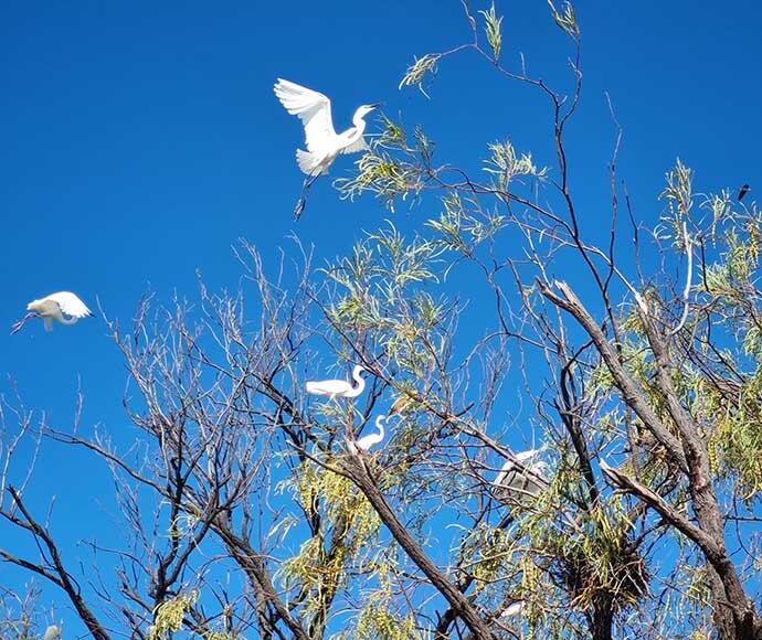
Egret colony at South Arm, Narran Lake