Burning Mountain Nature Reserve Plan of Management
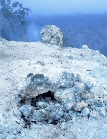
Burning Mountain Nature Reserve is situated in highly folded terrain approximately 25 kilometres north of Scone adjacent to the New England Highway. Although small in area, the reserve’s 14.5 hectares conserves interesting features which have resulted from the naturally occurring burning of an underground coal seam, believed to be one of only three such phenomenon in the world.
Publisher: Department of Environment and Climate Change NSW
Cost: Free
Language: English
ISBN: 0-73057-3893
/
ID: DECC19930001
File: PDF 53.97 KB / Pages 30
Name: burning-mountain-nature-reserve-plan-of-management-930001.pdf
Features which are evident both within and surrounding the nature reserve demonstrate:
- geomorphic features, such as ground subsidence in the wake of the advancing burning coal front: and
- geochemical alterations to soil and rock material.
Such alterations in turn give rise to fascinating and only partly understood plant and animal communities.
The significance of this unique area has been recognised by the Australian Heritage Commission, the National Trust and the Geological Society of Australia (NSW Division).
Photo: Burning Mountain Nature Reserve. Traditional Owners are the Wanaruah Aboriginal people of the Hunter Valley / OEH