Batemans Bay forms the entrance to ocean of the Clyde River. The Tollgate Islands are an iconic local feature of this estuary.
Batemans Bay is the largest bay between Jervis Bay to the north and Twofold Bay to the south. The estuary supports some of the most extensive and productive oyster leases on the south coast of New South Wales. It is also a popular tourist destination with plenty of opportunities for recreational activities.
Water quality
Batemans Bay has not been sampled as part of our monitoring program. We monitor water quality in the Clyde River and Cullendulla Creek, the main tributaries to Batemans Bay. The Clyde River estuary was last sampled in 2020–21 and Cullendulla Creek in 2017–18.
As part of our Beachwatch program we assess swimming suitability at 2 swimming sites in Batemans Bay using microbial indicators. Eurobodalla Shire Council collect samples at each site weekly between November and March to calculate the suitability grade. Sampling is ongoing. Each grade reflects the most recent 100 water quality results to April 2021. Find out more about how we monitor beach water quality.
Eurobodalla local government area swimming sites
| Swimming site name | Grade |
|---|---|
| Caseys Beach | Good |
| Surf Beach | Poor |
Ocean beaches can sometimes be unsuitable for swimming, especially after rainfall when stormwater and wastewater can overflow into swimming areas. Learn more about what the grades mean and how we grade swimming sites on the Beachwatch How we report webpage.
Water sampling and laboratory analysis were funded by Eurobodalla Shire Council.
Physical characteristics
| Estuary type | Bay |
|---|---|
| Latitude | –35.76 (ºS) |
| Longitude | 150.25 (ºE) |
| Catchment area | 28.0 km2 |
| Estuary area | 34.5 km2 |
| Estuary volume | 383,484 ML |
| Average depth | 11.1 m |
Notes: km2 = square kilometres; m = metres; ML = megalitres.
Land use
The foreshore of the Batemans Bay catchment is a focus for urban and rural residential growth. Development is concentrated at the entrance of the bay and the southern foreshore is more densely developed than the northern shore. Large areas of the catchment are forested and have relatively low disturbance. These include parts of Murramarang National Park as well as commercially managed state forest.
Batemans Bay webcam
The Batemans Bay coastal bar webcam provides real-time video of conditions within the Batemans Bay or Clyde River entrance bar immediately offshore to help with bar crossings and boat safety.
National and marine parks
- Murramarang National Park is the largest conservation area situated on the northern boundary of the Batemans Bay catchment.
- Batemans Marine Park is associated with this estuary.
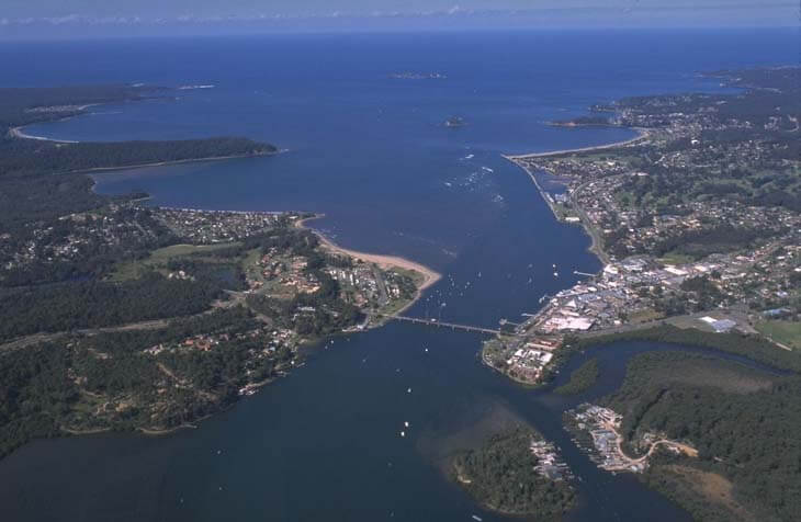
Aerial view of Batemans Bay.
Local government management
Local councils manage estuaries within their area, unless the estuary is attached to a marine park. This estuary is managed by Eurobodalla Shire Council and the NSW Department of Primary Industries and Regional Development as part of the Batemans Marine Park.