Salty Lagoon estuary has an intermittently closed/open entrance. It is located north of Evans Head on the north coast of New South Wales, tucked away in the heart of Broadwater National Park.
An artificial channel between Salty Creek and Salty Lagoon was closed in 2012 to improve ecosystem health following 65 years of effluent discharge in the adjacent lagoon. The expansive grasslands and saltmarsh provide excellent habitat for frogs, birdlife and fish.
Water quality report card
As part of our water quality monitoring program we assess the water quality and ecosystem health of an estuary using a range of relevant indicators. We sample a subset of the estuaries located between the Queensland border and Taree every 3 years. The most recent sampling in Lagoon was completed over the 2015–16 summer when 2 sites were sampled on a monthly basis.
This report card represents 2 water quality indicators that we routinely measure: the amount of algae present and water clarity. Low levels of these 2 indicators equate with good water quality.
Algae
Water clarity
Overall grade
The report card shows the condition of the estuary was fair with:
- algae abundance graded poor (D)
- water clarity graded excellent (A)
- overall estuary health graded fair (C).
Grades for algae, water clarity and overall are represented as:
- A – excellent
- B – good
- C – fair
- D – poor
- E – very poor.
Go to estuary report cards to find out what each grade means, read our sampling, data analysis and reporting protocols, and find out how we calculate these grades.
Physical characteristics
| Estuary type | Lagoon |
|---|---|
| Latitude (ºS) | –29.8 |
| Longitude (ºE) | 153.44 |
| Catchment area (km2) | 3.57 |
| Estuary area (km2) | 0.2 |
| Estuary volume (ML) | 68.9 |
| Average depth (m) | 0.4 |
Notes: km2 = square kilometres; m = metres; ML = megalitres.
Water depth and survey data
Bathymetric and coastal topography data for this estuary are available in our data portal.
Land use
The catchment of Salty Lagoon lies within Broadwater National Park and relatively undisturbed. Evans Head sewage treatment and road infrastructure are the only land-use changes in this catchment.
National and marine parks
- Salty Lagoon is located within Broadwater National Park.
- No marine parks are associated with this estuary.
Community involvement
- The National Parks and Wildlife Service offers potential volunteers many ways to get involved in a range of environmental and educational projects in our coastal national parks and reserves.
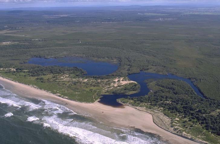
Aerial view of Salty Lagoon estuary.
Local government management
Local councils manage estuaries within their area unless the estuary is attached to a marine park. Richmond Valley Council manages this estuary and its Salty Lagoon Rehabilitation Project is ongoing.
Threatened species
Threatened species such as the southern swamp orchid exist around Salty Lagoon. Threatened shorebirds also congregate around the estuary entrance, which is undeveloped.
Read more about the biodiversity in our estuaries.