Lake Macquarie is located on the Hunter coast of New South Wales, just south of Newcastle. It is classed as a lake and has a permanently open, trained entrance named after its adjacent town, Swansea.
Lake Macquarie is Australia’s largest coastal saltwater lake and supports a diversity of habitat types throughout its many sections, including extensive seagrass meadows, mangroves, saltmarsh, rocky reefs, oyster reefs, sand flats, mud flats and deep open waters. It also provides huge recreational value for water-based activities.
Water quality report card
As part of our water quality monitoring program we assess the water quality and ecosystem health of an estuary using a range of relevant indicators. We sample 13 sites on a monthly basis in Lake Macquarie as part of a collaborative program with Lake Macquarie City Council and Central Coast Council.
The most recent sampling was completed over 2020–21. Sampling is ongoing. A summary of the monitoring program is available on the Lake Macquarie City Council website in the state of the environment reporting in their annual reports.
Go to estuary report cards to find out what each grade means, read our sampling, data analysis and reporting protocols, and find out how we calculate these grades.
As part of our Beachwatch program we assess swimming suitability at 4 swimming sites in Lake Macquarie using microbial indicators. Central Coast Council collect samples at each site weekly between October and April, and monthly from May to September, to calculate the suitability grade. Sampling is ongoing. Each grade reflects the most recent 100 water quality results to April 2022. Find out more about how we monitor beach water quality.
Central Coast local government area swimming sites
| Swim site name | Grade |
|---|---|
| Gwandalan | Poor |
| Summerland Point Baths | Good |
| Mannering Park Baths | Poor |
| Chain Valley Bay | Poor |
Estuarine, lake and lagoon water can sometimes be unsuitable for swimming, especially after rainfall, when stormwater and wastewater can overflow into swimming areas. Learn more about what the grades mean and how we grade swimming sites on the Beachwatch How we report webpage.
Water sampling and laboratory analysis was funded by Lake Macquarie City Council.
Physical characteristics
| Estuary type | Lake |
|---|---|
| Latitude | –33.09 (ºS) |
| Longitude | 151.66 (ºE) |
| Catchment area | 604.4 km2 |
| Estuary area | 114.1 km2 |
| Estuary volume | 64,6274.3 ML |
| Average depth | 5.7 m |
Tidal exchange volume
Tidal exchange volume or tidal prism data is available for this estuary. This tidal prism was measured in 1996.
| Tide state | Flow (ML) | Local tidal range (m) | Sydney Harbour tidal range (m) |
|---|---|---|---|
| Ebb flow | 1,180 | 1.18 | 1.34 |
| Flood flow | 10,890 | 1.16 | 1.29 |
Notes: km2 = square kilometres; m = metres; m3 = cubic metres; ML = megalitres.
Water depth and survey data
Bathymetric and coastal topography data for this estuary are available in our data portal.
Land use
Lake Macquarie drains a highly urbanised catchment. Other land use includes industrial and agricultural businesses. The western reaches of the catchment remain forested and protected within national parks.
Water use
Find out about water use in Lake Macquarie–Tuggerah catchment, including information about major water users, real-time flow data, and environmental and water sharing plans.
Web cam
The Swansea bar crossing web camera provides real-time video of conditions within the river entrance immediately offshore to help with bar crossings and boat safety.
National and marine parks
- Watagans National Park and Sugarloaf State Conservation Area are located within the western catchment of this estuary.
- This estuary does not flow into a marine park.
Community involvement
- The Central Coast Council Landcare Program helps coordinate a number of volunteer environmental groups. This includes Lake Macquarie Landcare, which supports dozens of local volunteer groups working to care for the environment around Lake Macquarie.
- The Central Coast Council's Environmental groups webpage provides links and information about a range of environmental groups located within the catchment.
- Volunteer with the Watagan weeders and help restore native bushland in Watagan National Park.
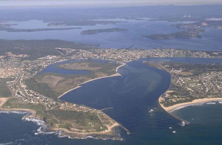
Aerial view of Lake Macquarie
Local government management
Local councils manage estuaries within their area unless the estuary is attached to a marine park.
Lake Macquarie Council manages the Lake Macquarie estuary, and Central Coast Council manages about 15% of the southern Lake Macquarie catchment area.
Threatened species
Lake Macquarie supports habitat for many threatened species, such as the endangered swift parrot.
Read more about the biodiversity in our estuaries.