Coffs Creek is a barrier river estuary located in Coffs Harbour on the mid-north coast of New South Wales. The entrance is untrained and constricted, and the shallow tidal waters are a popular spot for beachgoers.
The estuary sits entirely within the city limits and is mostly lined with mangroves.
Water quality report card
As part of our water quality monitoring program we assess the water quality and ecosystem health of an estuary using a range of relevant indicators. We sample a subset of the estuaries located between the Queensland border and Taree every 3 years. The most recent sampling in Coffs Creek was completed over the 2021–22 summer, when 2 sites were sampled on a monthly basis.
This report card represents 2 water quality indicators that we routinely measure: the amount of algae present and water clarity. Low levels of these 2 indicators equate with good water quality.
Algae
Water clarity
Overall grade
The report card shows the condition of the estuary was fair with:
- algae abundance graded very poor (E)
- water clarity graded good (B)
- overall estuary health graded fair (C).
Grades for algae, water clarity and overall are represented as:
- A – excellent
- B – good
- C – fair
- D – poor
- E – very poor.
Go to estuary report cards to find out what each grade means, read our sampling, data analysis and reporting protocols, and find out how we calculate these grades.
Coffs Harbour City Council, in collaboration with the University of New England’s EcoHealth Program, has carried out detailed ecosystem health monitoring in Coffs Creek. The results of the monitoring program, including a detailed water quality report card, are available on the Coffs Harbour City Council website.
We have monitored water quality in Coffs Creek since 2009. This table shows the water quality grades for this estuary over that time.
| Year | Algae | Water clarity | Overall grade |
|---|---|---|---|
| 2009–10 | D | C | D |
| 2012–13 | C | B | C |
| 2015–16 | D | C | C |
| 2018–19 | D | B | C |
Physical characteristics
| Estuary type | Barrier river |
|---|---|
| Latitude | –30.30 (ºS) |
| Longitude | 153.14 (ºE) |
| Catchment area | 24 km2 |
| Estuary area | 0.5 km2 |
| Estuary volume | 292.7 ML |
| Average depth | 0.6 m |
Notes: km2 = square kilometres; m = metres; ML = megalitres.
Water depth and survey data
Bathymetric and coastal topography data for this estuary are available in our data portal.
Land use
The catchment of Coffs Creek has seen a lot of disturbance. Urban development has driven much of the land-use changes, along with industrial development and horticulture, such as banana plantations. Less than 20% of the catchment remains as forest.
National and marine parks
- Coffs Creek is part of the Solitary Islands Marine Park (PDF 2.1MB).
Community involvement
- Coffs Harbour Regional Landcare provides workshops and volunteer work opportunities along the Coffs Coast. It organises Friends of Coffs Creek Working Bees, which occur regularly in and around Coffs Creek.
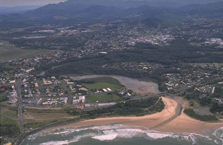
Aerial view of Coffs Creek
Local government management
Local councils manage estuaries within their area unless the estuary is attached to a marine park.
Coffs Creek estuary is managed by Coffs Harbour City Council. Information about this estuary can be found on the council’s Coffs Creek webpage.
The estuary is located within the Solitary Islands Marine Park.
Threatened species
Estuaries are important to our native animals as they provide important habitat, shelter and breeding grounds.
A significant ‘camp’ of the threatened grey-headed flying fox is located at Coffs Creek.
Read more about the biodiversity in our estuaries.