Pittwater is situated in the Sydney Metropolitan district of New South Wales. It is classified as a tide-dominated drowned river valley estuary with an open entrance. This estuary is one of the bodies of water that separate the Greater Sydney Metropolitan Region and Central Coast regions.
Pittwater is a large embayment connected to the Hawkesbury River estuary where the river enters the sea. Pittwater is popular for boating, fishing, sailing and swimming.
Water quality report card
As part of our water quality monitoring program we assess the water quality and ecosystem health of an estuary using a range of relevant indicators. We have supported Northern Beaches Council develop and carry out a monitoring program to assess the water quality of estuaries in their local government area. Sampling is carried out fortnightly between October and April each year. Five sites are sampled in Pittwater.
The monitoring program has been ongoing since 2017. The most recent sampling was completed over the 2023–24 summer.
This report card represents 2 water quality indicators that we routinely measure: the amount of algae present and water clarity. The numerical scores for these 2 indicators are averaged to give the overall grade.
Algae
Water clarity
Overall grade
The report card shows the condition of the estuary was excellent with:
- algae abundance graded good (B)
- water clarity graded excellent (A)
- overall estuary health graded excellent (A).
Grades for algae, water clarity and overall are represented as:
- A – excellent
- B – good
- C – fair
- D – poor
- E – very poor.
Go to estuary report cards to find out what each grade means, read our sampling, data analysis and reporting protocols, and find out how we calculate these grades.
We have monitored water quality in Pittwater since 2017. This table shows the water quality grades for this estuary over the past 7 years.
| Year | Algae | Water clarity | Overall grade |
|---|---|---|---|
| 2023–24 | B | A | A |
| 2022–23 | A | A | A |
| 2021–22 | B | A | A |
| 2020–21 | B | A | A |
| 2018–19 | A | A | A |
| 2017–18 | A | A | A |
Physical characteristics
| Estuary type | Drowned river valley |
| Latitude (ºS) | –33.58 |
| Longitude (ºE) | 151.32 |
| Catchment area (km2) | 50.8 |
| Estuary area (km2) | 18.4 |
| Estuary volume (ML) | 181,836.2 |
| Average depth (m) | 9.9 |
Notes: km2 = square kilometres; m = metres; ML = megalitres.
Water depth and survey data
Bathymetric and coastal topography data for this estuary are available in our data portal.
Land use
The Pittwater catchment is moderately disturbed with urban areas to the south east and the conservation area of Ku-ring-gai Chase National Park to the north west. Pittwater is a popular site for water recreation, such as sailing and fishing.
National and marine parks
- Ku-ring-gai Chase National Park is the largest conservation area in this catchment.
- This estuary does not flow into a marine park, but it is adjacent to the Barrenjoey Head Aquatic Reserve.
Community involvement
- The Northern Beaches Coastal Environment Centre is a community-based learning centre that focuses on raising awareness about the local coastal environment and how to care for it.
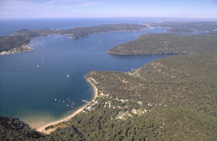
Aerial view of Pittwater estuary.
Local government management
Local councils manage estuaries within their area. Where the estuary is attached to a marine park, marine park management teams are responsible for ensuring compliance with park zoning. Northern Beaches Council manages this estuary.
Threatened species
This estuary supports the endangered ecological community, coastal saltmarsh, which provides habitat for many species, including the endangered bush stone-curlew.
Read more about the biodiversity in our estuaries.