Bellambi Lake is located south of Sydney in North Wollongong. It is classed as a creek with an entrance that is intermittently open and closed to the ocean.
Bellambi Lake is part of the Bellambi Lake Reserve at Sandpit Point and is an important cultural heritage area for the local Aboriginal community. The reserve includes a lagoon and small islands surrounded by swamp oaks, coastal sclerophyll and saltmarsh.
Water quality report card
As part of our water quality monitoring program we assess the water quality and ecosystem health of an estuary using a range of relevant indicators. We sample a subset of the estuaries between Wollongong and the Victorian border every 3 years. The most recent sampling in Bellambi Lake was completed over the 2022–23 summer, when 2 sites were sampled on a monthly basis.
Algae
Water clarity
Overall grade
This report card represents 2 water quality indicators that we routinely measure: the amount of algae present and water clarity. Low levels of these 2 indicators equate with good water quality. The numerical scores for these 2 indicators are averaged to give the overall grade.
The report card shows the condition of the estuary was poor with:
- algae abundance graded fair (C)
- water clarity graded very poor (E)
- overall estuary health graded poor (D).
Grades for algae, water clarity and overall are represented as:
- A – excellent
- B – good
- C – fair
- D – poor
- E – very poor.
Go to estuary report cards to find out what each grade means, read our sampling, data analysis and reporting protocols, and find out how we calculate these grades.
We have monitored water quality in Bellambi Lake since 2008. This table shows the water quality grades for this estuary over that time.
| Year | Algae | Water clarity | Overall grade |
|---|---|---|---|
| 2022–23 | C | E | D |
| 2008–09 | C | B | B |
Physical characteristics
| Estuary type | Creek |
|---|---|
| Latitude | –34.38 (ºS) |
| Longitude | 150.92 (ºE) |
| Catchment area | 1.3 km2 |
| Estuary area | 0.03 km2 |
| Estuary volume | 7.3 ML |
| Average depth | 0.2 m |
Notes: km2 = square kilometres; m = metres; ML = megalitres.
Water depth and survey data
Bathymetric and coastal topography data for this estuary are available in our data portal.
Land use
The catchment for Bellambi Lake is highly disturbed, with over 90% of land use changed to urban areas. The towns of Corrimal and East Corrimal, to the north of Wollongong, are within this catchment.
National and marine parks
- There is no conservation area in the Bellambi Lake catchment.
- There is no marine park associated with the Bellambi Lake estuary.
Area of significance
Bellambi Lake is listed as an area of significance for the Wollongong area as part of Bellambi Lake and Sandspit Point. The area has significant Aboriginal cultural heritage, with middens found in the area. It also contains ecologically important habitat for birds.
Community involvement
- There are over 60 bushcare groups in the Wollongong area. Bushcare volunteers help regenerate and care for local bushland.
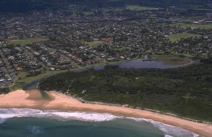
Aerial view of Bellambi Lake.
Local government management
Local councils manage estuaries within their area. Where an estuary is attached to a marine park, marine park management teams are responsible for ensuring compliance with marine park zoning.
Wollongong City Council manages this estuary.
Threatened species
Many threatened bird species have been reported in the Bellambi Lake catchment area, including the white-bellied sea eagle.
Read more about the biodiversity in our estuaries.