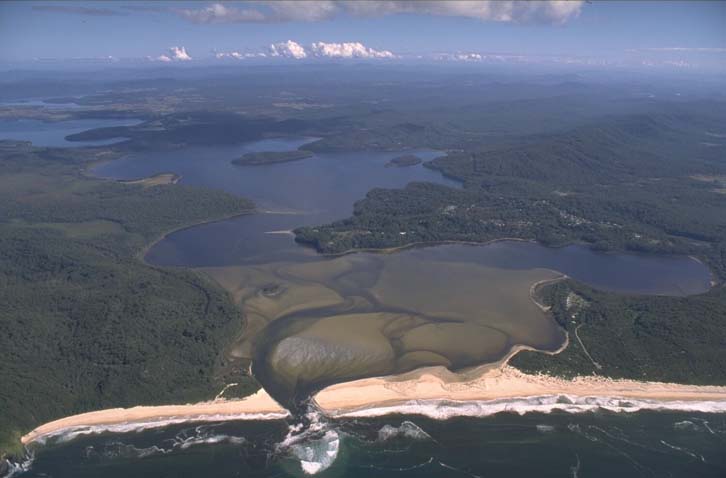
Smiths Lake estuary is located on the mid-north coast of New South Wales. It is classed as a lake with an entrance that intermittently opens to the sea.
Occasionally the lake is artificially opened by council to prevent flooding of low-lying areas. The entrance is predominantly closed, so most of the time the water level depends on the amount of runoff and evaporation that occurs.
Smiths Lake is a popular tourist destination, especially in summer. Most development is concentrated around the township on the north side of the lake, with the vast majority of the shoreline undeveloped.
Water quality
As part of our water quality monitoring program we assess the water quality and ecosystem health of an estuary using a range of relevant indicators. We sample 3 sites on a monthly basis over summer in Smiths Lake as part of a collaborative program with MidCoast Council.
The most recent sampling was completed over the 2021–22 summer. The results of the monitoring program, including a detailed water quality report card, are available on the MidCoast Council website.
Go to estuary report cards to find out what each grade means, read our sampling, data analysis and reporting protocols, and find out how we calculate these grades.
Physical characteristics
| Estuary type | Lake |
|---|---|
| Latitude (ºS) | –32.4 |
| Longitude (ºE) | 152.52 |
| Catchment area (km2) | 28 |
| Estuary area (km2) | 10 |
| Estuary volume (ML) | 23,552.5 |
| Average depth (m) | 2.4 |
Notes: km2 = square kilometres; m = metres; ML = megalitres.
Water depth and survey data
Bathymetric and coastal topography data for this estuary are available in our data portal.
Land use
About one-quarter of the Smiths Lake catchment has been altered by urban development, particularly around the north shore of the lake. Around three-quarters of the catchment remains forested and is managed by Forestry NSW and in conservation areas.
National and marine parks
- Myall Lakes National Park is the largest conservation area in this catchment. Parts of the catchment also fall within the Wallingat National Park.
- This estuary forms part of Port Stephens–Great Lakes Marine Park.
Community involvement
- Karuah and Great Lakes Landcare is the umbrella organisation for the local area and supports a range of groups and projects within the Smiths Lake catchment.
- Smiths Lake Landcare Group meet weekly to manage invasive weeds and litter along Smiths Lake Foreshore Reserve.

Aerial view of Smiths Lake estuary.
Local government management
Local councils manage estuaries within their area unless the estuary is attached to a marine park. MidCoast Council manages this estuary. More information can be found on the council’s Smiths Lake webpage.
Threatened species
Pied oystercatchers are regularly spotted around the shorelines of Smiths Lake, particularly around the estuary entrance.
Read more about the biodiversity in our estuaries.