Natural rainfall and dam spills achieved a range of ecological outcomes in the Border Rivers system in 2021–22.
Key outcomes
Under wet to very wet conditions, significant flows in the catchment met environmental demands, resulting in:
- continuous connection to the Barwon River for the whole year
- multiple flow events in the Boomi River across a range of flow categories including small and large freshes, bankfull and overbank events
- inundation of large areas of the floodplain
- summer flows in Morella Watercourse.
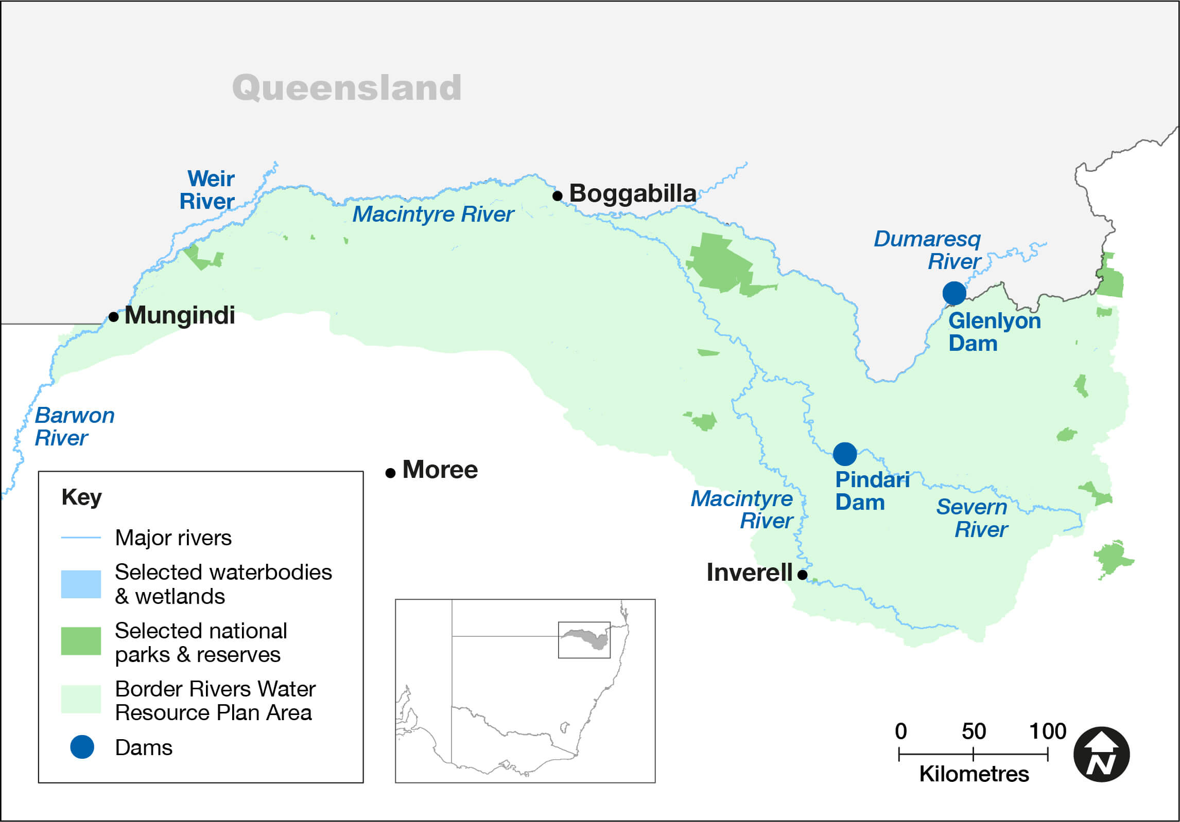
Border Rivers catchment area map.
Catchment conditions
During the 2021–22 year weather patterns in the Border Rivers region were driven by various climate conditions, including a strong La Niña event. This resulted in high rainfall and moderate temperatures, with significant flows throughout the system including inflows passed from full storages.
Higher than average flows and significant floodplain inundation occurred through the catchment. These circumstances negated the need to deliver water for the environment throughout the water year.
About the catchment
The Border Rivers catchment hugs the New South Wales–Queensland border in north-east New South Wales and covers an area of 24,000 square kilometres. Located in a temperate and sub-tropical climatic zone, rainfall is typically summer dominant with an annual average rainfall of 620 millimetres at Goondiwindi.
The major tributaries of the catchment are the Macintyre, Severn, Dumaresq and Weir rivers and Macintyre Brook, becoming the Barwon River near Mungindi. The Border Rivers catchment has 2 major water storages – the Pindari Dam on the Severn River in New South Wales, and Glenlyon Dam on Pike Creek in Queensland.
The Morella Watercourse, including Boobera and Pungbougal lagoons, are located on the Macintyre River floodplain and are important cultural sites for Aboriginal people. These wetlands are also listed as a site of national importance in the Directory of Important Wetlands in Australia.
Traditional owners
The Border Rivers catchment is Country to the Bigambul, Euahlayi, Githabul, Kambuwal, Gomeroi/Kamilaroi, Kwiambul, and Ngarabal First Nations.
Watering aims
The Border Rivers Catchment – Water for the Environment: Annual Priorities 2021–22 was developed under a dry resource-availability scenario. Aims for the use of water for the environment were to:
- focus efforts on supporting native fish populations in the Severn, Dumaresq, Macintyre and upper Barwon rivers
- deliver flows for fish breeding, recruitment, and connectivity.
Water managers had planned to deliver a small fresh to support native fish on 2 occasions, but they did not need to complete the deliveries because wet to very wet conditions emerged. The resulting rainfall and natural flows:
- improved ecological health and resilience
- restored key floodplain and wetland linkages
- provided opportunities for plants and animals to breed, move and thrive throughout the catchment.
Water delivery
This year no managed deliveries of water for the environment were made. However, significant flows were observed throughout the catchment in both regulated and unregulated watercourses.
The Pindari Stimulus flow was triggered for use but was not delivered because natural flows negated its need. The Pindari translucency rule provided flows all year and after July 2021, inflows were passed as the dam was full.
Outcomes
Some ecological highlights from this year include wide scale floodplain inundation, frequent flows in Morella Watercourse and Boomi River, small-scale colonial waterbird breeding and many opportunities for aquatic and floodplain species to complete all or part of their life cycles.
Although no large-scale waterbird breeding occurred in the catchment, in mid-2022 many hundreds of juvenile straw-necked ibis were observed foraging on inundated floodplains, most likely fledged from neighbouring catchments.
Case study: Building Boomi River resilience
Prior to March 2021, the last large flow through Boomi River with overbanking and some floodplain inundation was in September 2016. From 2017 to early 2021 there were few flows and several cease-to-flow periods, the longest lasted about 180 days in late 2019.
Over the last year and a half, Boomi River has recorded consecutive flows and significant local rainfall. This has included large-scale floodplain inundation.
Although these larger flows and floodplain inundation events can affect communities and infrastructure, they are critical to the persistence, resilience and health of floodplain environments and aquatic species. They replenish deep soil moisture and provide for nutrient and geological processes. The flows also provide connectivity for life cycle completion and maintaining population genetic diversity.
Flows observed in the last year provided local plants and animals the ability to complete life cycles and supported juveniles that bred and dispersed from other catchments.
The Boomi River is an important floodplain anabranch in the NSW Border Rivers. The river breaks away from the Macintyre River with a regulator controlling inflows. The river receives flows during very high flow events in the catchment as well as stock and domestic replenishment flows. The river and its floodplain contain significant water-dependent environmental assets including:
- the Lowland Darling River aquatic ecological community, which includes native fish and aquatic invertebrates in natural drainage systems of the Border Rivers
- nationally significant waterbirds and fish
- woody and non-woody wetland vegetation.
In general, the fish community in Boomi River is rated to be in a good condition by NSW Department of Primary Industries – Fisheries. The Border Rivers has up to 16 native fish species, with Boomi River having an indicative distribution of endangered olive perchlet, purple-spotted gudgeon, and vulnerable silver perch. Like some other rivers in the catchment, Boomi River has an abundance of good habitat, including large woody habitat.
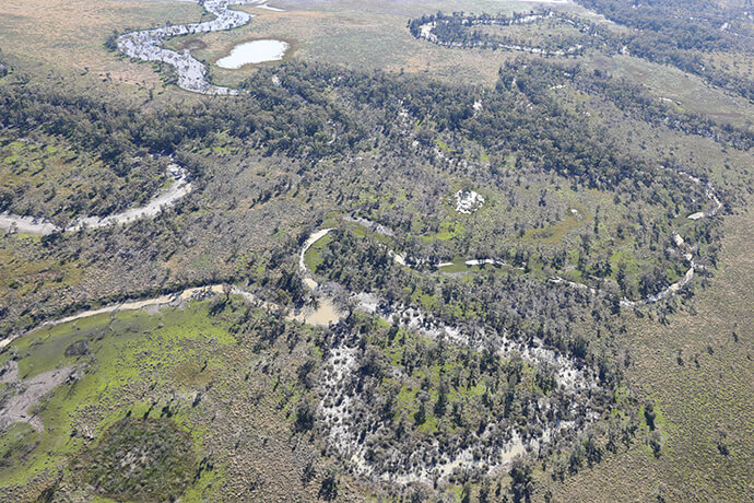
Boomi River’s inundated anabranches, a floodplain lagoon, and various waterholes.