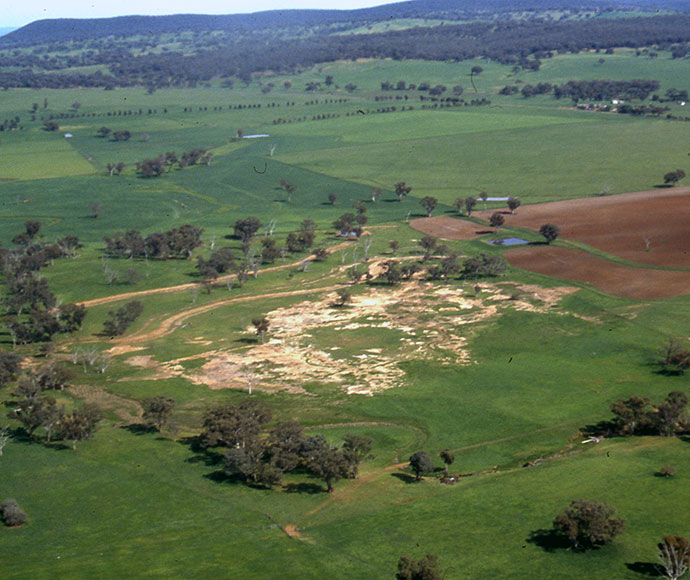
Salinity occurs in many parts of New South Wales. Examples include:
- dryland salinity, which is widespread on the western slopes and in the Hunter Valley and Sydney Basin
- irrigation and river salinity, which are seen in the southern irrigation areas of New South Wales and in the Macquarie, Castlereagh, Bogan, Namoi and Gwydir rivers
- urban salinity, which affects more than 40 towns across the Murray–Darling Basin in New South Wales and in the lower Hunter valley and Western Sydney.
Hydrogeological landscapes
A hydrogeological landscape (HGL) describes the soil, rocks, climate and landforms that influence salinity in a given area and provides salinity management options for specific parts of the landscape. To help identify areas where salinity hazards exist, HGL mapping is taking place progressively across New South Wales.
You can download HGL reports and mapping products for selected areas of New South Wales from the SEED portal. These areas include:
- Braidwood
- Capertee and Coxs River Valleys
- Central West Catchment
- Eastern Murray Catchment
- Goulburn
- South Creek Catchment
- Sydney Metropolitan Western Study Area
- Western Sydney.
General management actions for salinity have been developed to complement the HGL mapping. These are outlined in Guidelines for managing salinity in rural areas.
Line work for mapped HGL areas and associated thematic maps are available on the department's soil data viewer (eSPADE).

Salinity research site at Cundumbul, near Wellington, New South Wales.
More information
- Guidelines for managing salinity in rural areas
- Guidelines to accompany map of salinity potential in Western Sydney
- Hydrogeological landscapes for the Eastern Murray Catchment
- Hydrogeological landscapes of the Capertee and Coxs River Valleys
- Hydrogeological landscape and salinity hazard mapsopens a new window
- Salinity potential of Western Sydneyopens a new window
SoilTalk! news
Stay up to date on the latest news and events about landscapes, soils and systems in New South Wales.